
Cycling in Taninges
Discover Taninges by bike with routes created by our community.
Region portrait
Get to know Taninges
Find the right bike route for you through Taninges, where we've got 104 cycle routes to explore. The routes you most commonly find here are of the hilly or uphill type. Most people get on their bikes to ride here in the months of May and August.
12,718 km
Tracked distance
104
Cycle routes
3,471
Population
Community
Most active users in Taninges


From our community
The best bike routes in Taninges


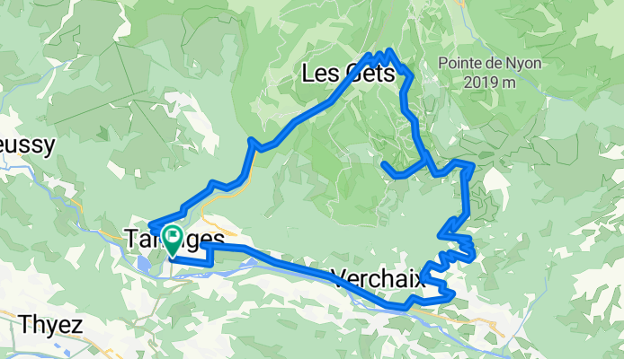
COL DES GETS (Por Taninges)
Cycling route in Taninges, Auvergne-Rhône-Alpes, France
El Col des Gets es un puerto de montaña ubicado en los Alpes franceses, en la región de Alta Saboya, dentro de la comuna de Les Gets, cerca de la ciudad de Taninges. Se sitúa en una de las zonas más pintorescas de los Alpes del Norte, entre el valle del Giffre y el valle de Morzine. Este puerto cone
- 11.4 km
- Distance
- 585 m
- Ascent
- 62 m
- Descent


Joux Plane via alternate route
Cycling route in Taninges, Auvergne-Rhône-Alpes, France
Unknown Paved climb until 1500 metres, then trails and gravel to Col du Ranfolly then Col de Joux Plane. Then a quick unpaved dash higher to Croix de Mapellet.
Started descending the main road then took old, old, old road/trail for half of descent, then alternated paved road down.
<p
- 48.2 km
- Distance
- 1,278 m
- Ascent
- 1,278 m
- Descent


Col de la Ramaz and Col des Charmettes
Cycling route in Taninges, Auvergne-Rhône-Alpes, France
Ramaz will be in the Tour in 2016. This is the steep side they will descend. The final climbing to Charmettes is on a gravel road.
- 47.1 km
- Distance
- 1,462 m
- Ascent
- 1,462 m
- Descent

Col de Joux Plane / Encrenaz / Ramaz
Cycling route in Taninges, Auvergne-Rhône-Alpes, France
<img src="http://farm4.static.flickr.com/3466/3771933437_9b53865b81_m.jpg" alt="Steep! Col de la Ramaz" width="240" height="165" />
- 71.3 km
- Distance
- 2,475 m
- Ascent
- 2,021 m
- Descent
Discover more routes
 2019-06-01 / Cols des Gets, de la Joux Verte, du Ranfolly et de Joux Plane
- Distance
- 78.8 km
- Ascent
- 2,204 m
- Descent
- 2,202 m
- Location
- Taninges, Auvergne-Rhône-Alpes, France
 Cols Ramaz, Joux Verte, Encrenaz, Joux Plane
- Distance
- 105.7 km
- Ascent
- 2,841 m
- Descent
- 2,845 m
- Location
- Taninges, Auvergne-Rhône-Alpes, France
 Avenue des Thézières 796, Taninges to Route du Bettex 3747, Saint-Gervais-les-Bains
- Distance
- 196.1 km
- Ascent
- 5,577 m
- Descent
- 4,875 m
- Location
- Taninges, Auvergne-Rhône-Alpes, France
 Joux Plane via Lesgets
- Distance
- 48.3 km
- Ascent
- 1,123 m
- Descent
- 1,123 m
- Location
- Taninges, Auvergne-Rhône-Alpes, France
 Franse Alpen stage6
- Distance
- 63.6 km
- Ascent
- 1,126 m
- Descent
- 1,340 m
- Location
- Taninges, Auvergne-Rhône-Alpes, France
 Col de la Ramaz is closed
- Distance
- 29.5 km
- Ascent
- 875 m
- Descent
- 875 m
- Location
- Taninges, Auvergne-Rhône-Alpes, France
 Avenue des Thézières 796, Taninges nach Route du Bettex 3747, Saint-Gervais-les-Bains
- Distance
- 196.1 km
- Ascent
- 5,577 m
- Descent
- 4,875 m
- Location
- Taninges, Auvergne-Rhône-Alpes, France
 Taninges Mouille rosse
- Distance
- 11.2 km
- Ascent
- 867 m
- Descent
- 23 m
- Location
- Taninges, Auvergne-Rhône-Alpes, France