Premium Badge Download on the App Store Get it on Google Play Turn-by-turn Navigation Offline Maps Bike Type Optimized Routing Premium Maps Custom Bike Computer Export Routes Route Previews Fall Detection Premium Support

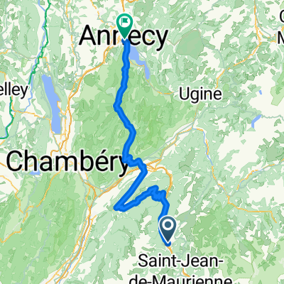
Cycling Route in La Chambre, Auvergne-Rh么ne-Alpes, France

TT COL DE LA MADELINE

0
Open this route in the Bikemap app

Open this route in the Bikemap app

Open this route in Bikemap Web

Open this route in Bikemap Web

46 km
Distance
1595 m
Ascent
1618 m
Descent
-:-- h
Duration
-- km/h
Avg. Speed
--- m
Max. Elevation

About This Route

Beautiful col and one of the harder cols of the Alpes with a nice panorama on the Lauzi猫re massif.

The Col de la Madeleine is situated in聽Rhone Alpes聽and belongs to the Alps. Starting from La Chambre - D 76, the Col de la Madeleine ascent is 19.8 km long. Over this distance, you climb 1520 heightmeters. The average percentage is thus 7.7 %.

This cycling route is ideal for: Road bike

You will cycle on the following surfaces: Paved

Customize this cycling route with the Bikemap route planner.

Make it yours!

Did you know? You can use this route as a template in our cycling route planner if you don't wish to start from scratch. Customize it based on your needs to plan your perfect cycling tour.

Open it in the app