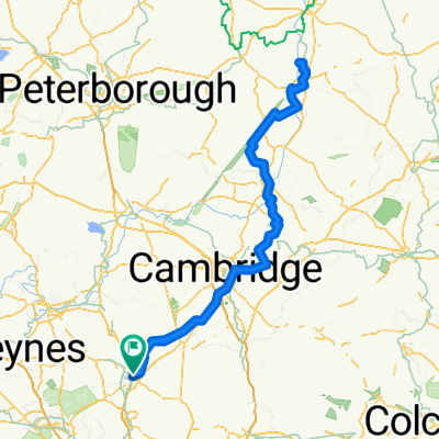
Cycling Route in Baldock, England, United Kingdom
Drinking Bird
0

Open this route in the Bikemap app

Open this route in Bikemap Web
79
km
Distance
Distance
290
m
Ascent
Ascent
291
m
Descent
Descent
-:--
h
Duration
Duration
--
km/h
Avg. Speed
Avg. Speed
---
m
Max. Elevation
Max. Elevation