Premium Badge Download on the App Store Get it on Google Play Turn-by-turn Navigation Offline Maps Bike Type Optimized Routing Premium Maps Custom Bike Computer Export Routes Route Previews Fall Detection Premium Support

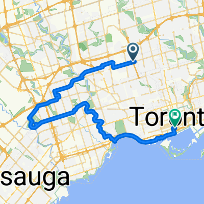
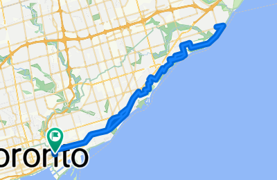
Cycling Route in Toronto, Ontario, Canada

Pop-cycle ride

2
Open this route in the Bikemap app

Open this route in the Bikemap app

Open this route in Bikemap Web

Open this route in Bikemap Web

58 km
Distance
235 m
Ascent
234 m
Descent
-:-- h
Duration
-- km/h
Avg. Speed
--- m
Max. Elevation

About This Route

Ride from Dark Horse East to Rouge Hill and back along the Waterfront Trail. Stop en route for a popsicle.

Alternate Route/Variation:

On the way back, continue north on Brimley Rd and left onto St Clair Ave. Turn left on O'Connor Dr, left again at Woodbine Ave (or any of the smaller side street after Woodbine). Make a right onto Cosburn Ave, a left at Pape Ave, right at Riverdale Ave, and the left to Carlaw. Then join up again with the mapped route turning right at Dundas St, and left at Hamilton Ave to Dark Horse.

You will cycle on the following surfaces: Paved

Customize this cycling route with the Bikemap route planner.

Make it yours!

Did you know? You can use this route as a template in our cycling route planner if you don't wish to start from scratch. Customize it based on your needs to plan your perfect cycling tour.

Open it in the app