Premium Badge Download on the App Store Get it on Google Play Turn-by-turn Navigation Offline Maps Bike Type Optimized Routing Premium Maps Custom Bike Computer Export Routes Route Previews Fall Detection Premium Support

Cycling Route in Horben, Baden-Württemberg, Germany

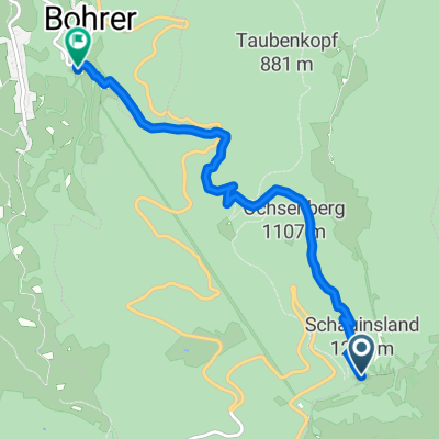
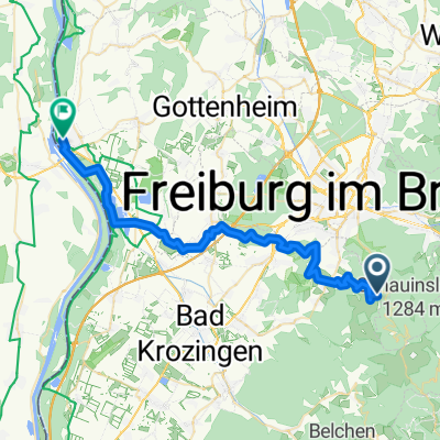
Schauinsland- Downhill- II

4
Open this route in the Bikemap app

Open this route in the Bikemap app

Open this route in Bikemap Web

Open this route in Bikemap Web

8 km
Distance
131 m
Ascent
860 m
Descent
-:-- h
Duration
-- km/h
Avg. Speed
--- m
Max. Elevation

About This Route

Vom Start auf 1.220 m Höhe geht es durch das Naturschutzgebiet Schauinsland mit Laub-Nadelwald und herrlichen Ausblicken über 750 Höhenmeter in ungefähr 1 Stunde bergab, über extra präparierte und ausgewiesene Waldwege zur Talstation.<br /><br /> Bergfahrt Erwachsener 8.00€ Fahrad 6.00€

This cycling route is ideal for: MTB

You will cycle on the following surfaces: Unpaved Gravel

Customize this cycling route with the Bikemap route planner.

Make it yours!

Did you know? You can use this route as a template in our cycling route planner if you don't wish to start from scratch. Customize it based on your needs to plan your perfect cycling tour.

Open it in the app