

Por las tablillas y el Cigüela
A cycling route starting in Alcázar de San Juan, Castille-La Mancha, Spain.
Overview
About this route
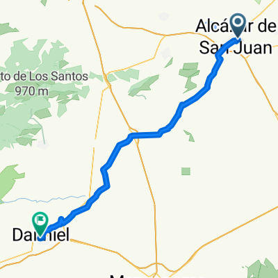
Sunday route to the tablillas. After that, we follow the course of the Cigüela until it joins the Záncara. Return to Alcázar via the Cañada Real.
- -:--
- Duration
- 41 km
- Distance
- 33 m
- Ascent
- 32 m
- Descent
- ---
- Avg. speed
- 651 m
- Max. altitude

Route quality
Waytypes & surfaces along the route
Waytypes
Track
26.7 km
(65 %)
Quiet road
4.1 km
(10 %)
Surfaces
Paved
3.3 km
(8 %)
Unpaved
23 km
(56 %)
Ground
18.5 km
(45 %)
Gravel
4.5 km
(11 %)
Route highlights
Points of interest along the route

Point of interest after 0 km
Salida desde rotonda del cementerio

Point of interest after 9.5 km
Laguna del Cerro Mesado

Point of interest after 12.3 km
Flamencos en las Tablillas del Záncara

Point of interest after 12.8 km
Fin de ruta de las Tablillas
Continue with Bikemap
Use, edit, or download this cycling route
You would like to ride Por las tablillas y el Cigüela or customize it for your own trip? Here is what you can do with this Bikemap route:
Free features
- Save this route as favorite or in collections
- Copy & plan your own version of this route
- Sync your route with Garmin or Wahoo
Premium features
Free trial for 3 days, or one-time payment. More about Bikemap Premium.
- Navigate this route on iOS & Android
- Export a GPX / KML file of this route
- Create your custom printout (try it for free)
- Download this route for offline navigation
Discover more Premium features.
Get Bikemap PremiumFrom our community
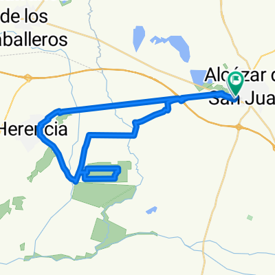
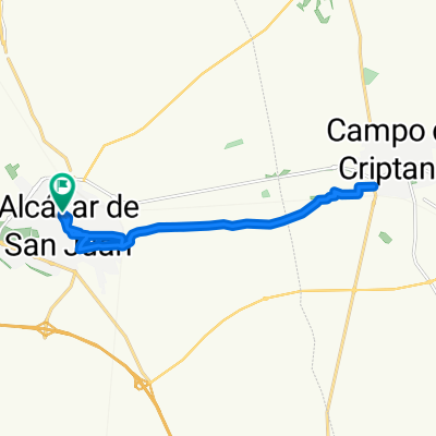
Other popular routes starting in Alcázar de San Juan
 De Calle San Antón a Plaza la Paz
- Distance
- 59.2 km
- Ascent
- 110 m
- Descent
- 133 m
- Location
- Alcázar de San Juan, Castille-La Mancha, Spain
 Calle de Don Quijote, Alcázar de San Juan a Calle de Don Quijote, Alcázar de San Juan
- Distance
- 35.3 km
- Ascent
- 126 m
- Descent
- 127 m
- Location
- Alcázar de San Juan, Castille-La Mancha, Spain
 Alcázar - Cristo Villajos - Criptana
- Distance
- 29.2 km
- Ascent
- 168 m
- Descent
- 165 m
- Location
- Alcázar de San Juan, Castille-La Mancha, Spain
 ciudad real 1
- Distance
- 406.9 km
- Ascent
- 2,031 m
- Descent
- 2,033 m
- Location
- Alcázar de San Juan, Castille-La Mancha, Spain
 Por las tablillas y el Cigüela
- Distance
- 41 km
- Ascent
- 33 m
- Descent
- 32 m
- Location
- Alcázar de San Juan, Castille-La Mancha, Spain
 Ruta Gran Prix del Verano
- Distance
- 16.6 km
- Ascent
- 51 m
- Descent
- 51 m
- Location
- Alcázar de San Juan, Castille-La Mancha, Spain
 Alcázar - Finca Antigua - Venta del Quijote
- Distance
- 101.2 km
- Ascent
- 399 m
- Descent
- 403 m
- Location
- Alcázar de San Juan, Castille-La Mancha, Spain
 ALCAZAR 09/08/2011 SALIDA VESPERTINA
- Distance
- 22.9 km
- Ascent
- 91 m
- Descent
- 92 m
- Location
- Alcázar de San Juan, Castille-La Mancha, Spain
Open it in the app