Premium Badge Download on the App Store Get it on Google Play Turn-by-turn Navigation Offline Maps Bike Type Optimized Routing Premium Maps Custom Bike Computer Export Routes Route Previews Fall Detection Premium Support

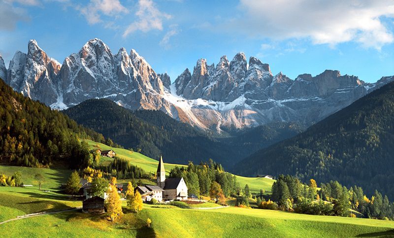
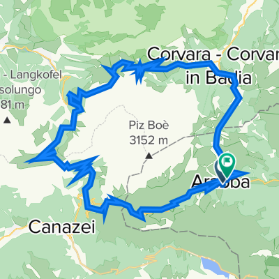
Cycling Route in Corvara, Trentino-Alto Adige, Italy

Dolomitok 3. nap

2
Open this route in the Bikemap app

Open this route in the Bikemap app

Open this route in Bikemap Web

Open this route in Bikemap Web

98 km
Distance
2555 m
Ascent
2555 m
Descent
-:-- h
Duration
-- km/h
Avg. Speed
--- m
Max. Elevation

About This Route

Colfosco (1555 m) - Corvara (1524 m) - Passo Campolongo 1875 m - Arabba (1593 m) - Alfauro - Ruaz - Liviné - Salesei - Cernadoi - Collaz - Rucava - Colle Santa Lucia - Pian Fossal - Codalonga (1317 m) - Posalz - Passo Giau 2236 m -  Cortina d'Ampezzo (1213 m) - Passo Falzarego 2105 m - Passo Valparola 2192 m - Armentarola - San Cassiano - Costadedoi - La Villa (1421 m) - Corvara (1524 m) - Colfosco (1555 m)

Cernadoi-ban lehetőség van egérutat nyerni Pian Falzarego felé, ekkor a napi táv 53,4 km, a szintemelkedés pedig 1340 m lenne, de ekkor kimarad a Giau-hágó és Cortina d'Ampezzo.

Highlights Along The Route

POI Photo 1: Gergely Nándor

Photo

Passo Valparola 2192 m

POI Photo 2: Gergely Nándor

Photo

Passo Falzarego 2105 m

POI Photo 3: Gergely Nándor

Photo

Passo Campolongo 1875 m

More highlights are available with Bikemap for iOS and Android.

Route Photos

Customize this cycling route with the Bikemap route planner.

Make it yours!

Did you know? You can use this route as a template in our cycling route planner if you don't wish to start from scratch. Customize it based on your needs to plan your perfect cycling tour.

Open it in the app