- 68.4 km
- 856 m
- 857 m
- Bergamo, Lombardy, Italy
Giro della val Predosola (giro completo della valle dal nuovo sentiero)
A cycling route starting in Bergamo, Lombardy, Italy.
Overview
About this route
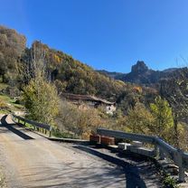
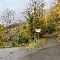
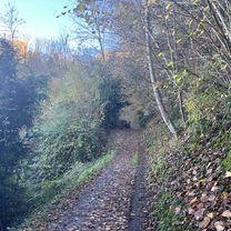
Today solo cycle exploration and into the wild, aimed at finding a trail that bypassed the big landslide that occurred a few years ago and thus reaching Ca' Barradoss. Goal achieved! Always from Colletto del Pizzo, I found a new, well-defined trail that descends the valley to the north, staying lower but always parallel to the old path. When you reach the landslide, you always follow a rising trail to connect with the old trail, which was interrupted just above. And here we are, finally, in no time and for the first time by bike at Ca' Barradossi, a break for a snack bar and then the long but fast descent of the valley, passing baita1, reaching the traczolino and closing the loop at the bend of Costa Bassa where we take the road back to Bergamo.
- -:--
- Duration
- 57.3 km
- Distance
- 647 m
- Ascent
- 647 m
- Descent
- ---
- Avg. speed
- ---
- Max. altitude
created this 9 years ago
Route highlights
Points of interest along the route

Point of interest after 29.1 km
Frana di Val Predosola

Point of interest after 29.5 km
Cà Barradossi

Point of interest after 30.9 km
Baita 1

Point of interest after 31.1 km
Piano di Predosola
Continue with Bikemap
Use, edit, or download this cycling route
You would like to ride Giro della val Predosola (giro completo della valle dal nuovo sentiero) or customize it for your own trip? Here is what you can do with this Bikemap route:
Free features
- Save this route as favorite or in collections
- Copy & plan your own version of this route
- Sync your route with Garmin or Wahoo
Premium features
Free trial for 3 days, or one-time payment. More about Bikemap Premium.
- Navigate this route on iOS & Android
- Export a GPX / KML file of this route
- Create your custom printout (try it for free)
- Download this route for offline navigation
Discover more Premium features.
Get Bikemap PremiumFrom our community
Other popular routes starting in Bergamo
- Viadanica- Foresto Sparso- Colle S. Giovanni- Grena
- Valsambusso
- 57.7 km
- 989 m
- 984 m
- Bergamo, Lombardy, Italy
- Giro della Pianca da Brembella
- 82.2 km
- 2,046 m
- 2,047 m
- Bergamo, Lombardy, Italy
- Galizia- Santella del Roccolo- Frasnadello
- 58.9 km
- 1,201 m
- 1,202 m
- Bergamo, Lombardy, Italy
- Leffe- San Rocco- Monte Croce- Trate- Colle Gallo
- 70.1 km
- 1,378 m
- 1,378 m
- Bergamo, Lombardy, Italy
- Madonna del Campino
- 46.3 km
- 206 m
- 180 m
- Bergamo, Lombardy, Italy
- Bruntino- Botta di Sedrina
- 38.6 km
- 557 m
- 557 m
- Bergamo, Lombardy, Italy
- Albenza- Camutaglio- Carosso- Cabacaccio
- 42 km
- 783 m
- 784 m
- Bergamo, Lombardy, Italy
Open it in the app


