Premium Badge Download on the App Store Get it on Google Play Turn-by-turn Navigation Offline Maps Bike Type Optimized Routing Premium Maps Custom Bike Computer Export Routes Route Previews Fall Detection Premium Support

Cycling Route in Sexten, Trentino-Alto Adige, Italy

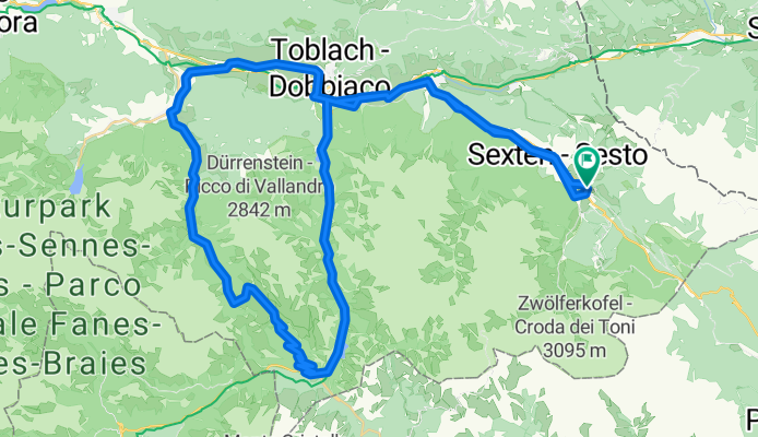
Plätzwiese - Stolla Alm

1
Open this route in the Bikemap app

Open this route in the Bikemap app

Open this route in Bikemap Web

Open this route in Bikemap Web

71 km
Distance
1076 m
Ascent
1076 m
Descent
-:-- h
Duration
-- km/h
Avg. Speed
--- m
Max. Elevation

About This Route

Start in Sexten/Moos über den Radweg nach Innichen, weiter nach Toblach, links abbiegen auf dem Radweg Richtung Cortina bis nach Schluderbach. Nach der Ferienanlage "Ploner" erreichen Sie auf der Forststrasse nach 7 Km und ca. 1 Stunde die Plätzwiese. Entlang der Plätzwiesen verfolgt sie die Hohe Gaisl und der Dürrenstein, nach kurzer Rast auf der urigen Almhütte Plätzwiese" (unbedingt einkehren) geht es weiter bis zum Hotel Hohe Gaisl, links abbiegen Richtung "Stolla" Alm, hier führt Sie ein flowiger Trail (technisch mittel) bis nach Brückele. Gleich nach dem Parkplatz links den Wanderweg nach Ausserprags nehmen, über diesen teilweise spritzigen Trail gelangen Sie nach ca. 10 km nach Ausserprags, von dort Richtung Niederdorf, Toblach zum Ausgangspunkt zurück. Tipp: von der Plätzwiese einen Abstecher zum Strudelkopf (2.400m) ca. 300 hm mit traumhafter Aussicht auf die umliegenden Dolomiten.

This cycling route is ideal for: MTB

You will cycle on the following surfaces: Paved Unpaved Gravel

Customize this cycling route with the Bikemap route planner.

Make it yours!

Did you know? You can use this route as a template in our cycling route planner if you don't wish to start from scratch. Customize it based on your needs to plan your perfect cycling tour.

Open it in the app