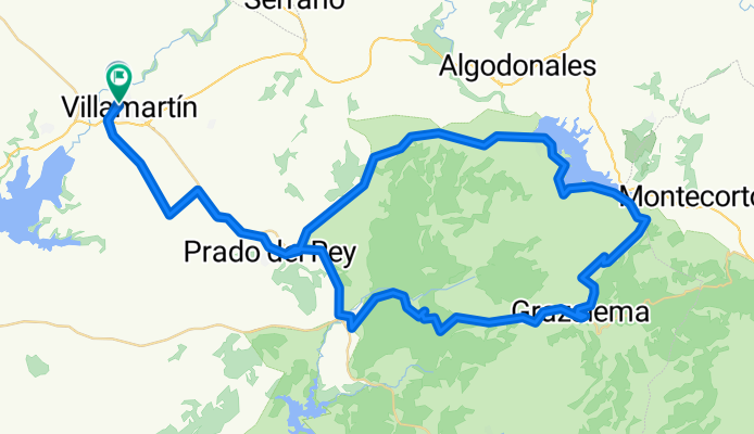
Premium Badge Download on the App Store Get it on Google Play Turn-by-turn Navigation Offline Maps Bike Type Optimized Routing Premium Maps Custom Bike Computer Export Routes Route Previews Fall Detection Premium Support

Cycling Route in VillamartĂ­n, Andalusia, Spain

VillamarĂ­n-Prado del Rey- Zahara-La Rivera- Grazalema-El BoyarĂ­n-El Bosque-VillamartĂ­n

0
Open this route in the Bikemap app

Open this route in the Bikemap app

Open this route in Bikemap Web

Open this route in Bikemap Web

97 km
Distance
1363 m
Ascent
1357 m
Descent
-:-- h
Duration
-- km/h
Avg. Speed
--- m
Max. Elevation

About This Route

Etapa de montaña que discurre por Villamartín a Prado con subida de Las Carrihuelas. Rompepiernas desde Prado a zahara con fortísima subida en el último km. Bordeamos el pantano e iniciamos subida a Grazalema por lo que conocemos como la Rivera. Subida al Boyarín con nivel elevado a la salida de este municipio y desde El Boyar a El Bosque fortísima bajada. Última subida a Prado por la Cuesta "de Jesulín" y bajada hasta el término de villamartín para llanear unos 10km hasta esta localidad donde finaliza la etapa.

This cycling route is ideal for: Road bike

You will cycle on the following surfaces: Paved

Customize this cycling route with the Bikemap route planner.

Make it yours!

Did you know? You can use this route as a template in our cycling route planner if you don't wish to start from scratch. Customize it based on your needs to plan your perfect cycling tour.

Open it in the app