Premium Badge Download on the App Store Get it on Google Play Turn-by-turn Navigation Offline Maps Bike Type Optimized Routing Premium Maps Custom Bike Computer Export Routes Route Previews Fall Detection Premium Support

Cycling Route in South Tucson, Arizona, United States of America

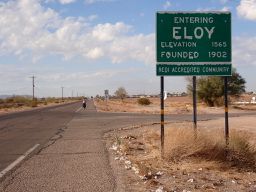
Tucson to Casa Grande

1
Open this route in the Bikemap app

Open this route in the Bikemap app

Open this route in Bikemap Web

Open this route in Bikemap Web

118 km
Distance
78 m
Ascent
395 m
Descent
8:29 h
Duration
13.9 km/h
Avg. Speed
752 m
Max. Elevation

About This Route

This was a very flat route. The initial mileage until getting on to the freeway service road was pretty much all on Tucson's outstanding Loop trail system. They're very well paved and are excellent for any type of riding. They made getting out of Tucson very easy. The riding along the I-10 service road was pretty painless, except for the noise of the freeway that we were riding along. There was very little traffic on the service road, which made it feel like we were riding on a very wide bicycle trail. Nearing Eloy, we left the freeway service road and were on various roads, all with little traffic. There was some road shoulder, but not a lot. With the low level of traffic, not a problem.

This cycling route is ideal for: Road bike MTB City bike

Route Photos

Customize this cycling route with the Bikemap route planner.

Make it yours!

Did you know? You can use this route as a template in our cycling route planner if you don't wish to start from scratch. Customize it based on your needs to plan your perfect cycling tour.

Open it in the app