

Schloss Orth nach Schloss Eckartsau
A cycling route starting in Orth an der Donau, Lower Austria, Austria.
Overview
About this route
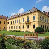
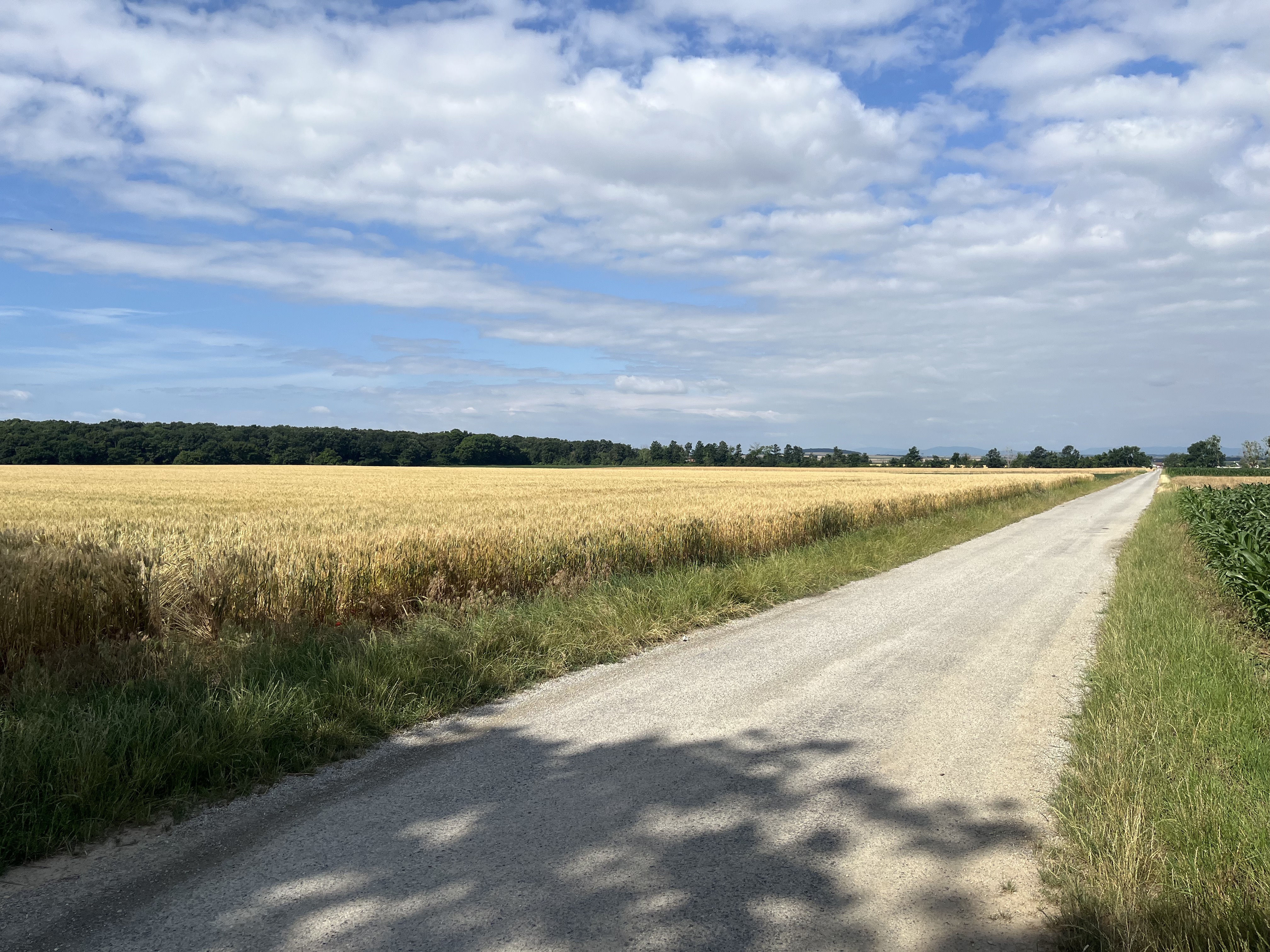
Die Strecke startet beim Schloss Orth. Hier befindet sich das schlossORTH Nationalpark-Zentrum mit Ausstellungen sowie das Auerlebnisgelände Schlossinsel. Von hier aus geht es auf der Uferstraße zum Hubertusdamm. Weiter geht es auf dem Donauradweg über den Damm. Der Weg verläuft von Orth nach Eckartsau auf einer langen, geraden Strecke, gesäumt von großen Wiesenflächen und Auwald. Bei Eckartsau führt der Weg anschließend nach links hinauf zum Schloss. Dort befindet sich eine Fahrrad-Servicestation im Schlosspark, und das Schloss-Cafe mit Shop lädt zum Verweilen ein. Die ausgedehnten Wiesenflächen rund um Schloss Eckartsau sind für Gäste zugänglich. Sie finden dort auch eine Nationalpark-Infostelle und eine Ausstellung. Die Rückfahrt erfolgt auf Wegen durch das Hinterland des Nationalparks zurück nach Orth.
- -:--
- Duration
- 17.5 km
- Distance
- 52 m
- Ascent
- 53 m
- Descent
- ---
- Avg. speed
- 158 m
- Avg. speed

Route photos

Route quality
Waytypes & surfaces along the route
Waytypes
Cycleway
8 km
(46 %)
Track
7.3 km
(42 %)
Surfaces
Paved
9.8 km
(56 %)
Unpaved
6.1 km
(35 %)
Asphalt
9.6 km
(55 %)
Gravel
5.6 km
(32 %)
Continue with Bikemap
Use, edit, or download this cycling route
You would like to ride Schloss Orth nach Schloss Eckartsau or customize it for your own trip? Here is what you can do with this Bikemap route:
Free features
- Save this route as favorite or in collections
- Copy & plan your own version of this route
- Sync your route with Garmin or Wahoo
Premium features
Free trial for 3 days, or one-time payment. More about Bikemap Premium.
- Navigate this route on iOS & Android
- Export a GPX / KML file of this route
- Create your custom printout (try it for free)
- Download this route for offline navigation
Discover more Premium features.
Get Bikemap PremiumFrom our community
Other popular routes starting in Orth an der Donau
 Schloss Orth nach Schloss Eckartsau
- Distance
- 17.5 km
- Ascent
- 52 m
- Descent
- 53 m
- Location
- Orth an der Donau, Lower Austria, Austria
 Wien -> Orths Donau
- Distance
- 35.8 km
- Ascent
- 105 m
- Descent
- 57 m
- Location
- Orth an der Donau, Lower Austria, Austria
 Orth 1
- Distance
- 64.7 km
- Ascent
- 335 m
- Descent
- 338 m
- Location
- Orth an der Donau, Lower Austria, Austria
 Moderate Route in Leopoldsdorf im Marchfelde nach Orth
- Distance
- 9.9 km
- Ascent
- 21 m
- Descent
- 0 m
- Location
- Orth an der Donau, Lower Austria, Austria
 Maria Ellend a.d. Donau - Hainburg
- Distance
- 27.7 km
- Ascent
- 112 m
- Descent
- 129 m
- Location
- Orth an der Donau, Lower Austria, Austria
 Orth Hainburg
- Distance
- 43.9 km
- Ascent
- 173 m
- Descent
- 168 m
- Location
- Orth an der Donau, Lower Austria, Austria
 Haslau-Maria Ellend to Lambrechtgasse, Vienna
- Distance
- 43 km
- Ascent
- 223 m
- Descent
- 192 m
- Location
- Orth an der Donau, Lower Austria, Austria
 Jägergrund, Orth an der Donau nach Fasanweg, Groß-Enzersdorf
- Distance
- 23.1 km
- Ascent
- 99 m
- Descent
- 93 m
- Location
- Orth an der Donau, Lower Austria, Austria
Open it in the app