- 148.6 km
- 1,173 m
- 1,173 m
- Birkenau, Hesse, Germany
Anfänger MTB Route
A cycling route starting in Birkenau, Hesse, Germany.
Overview
About this route
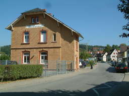
This MTB beginner route is great for newcomers who want to test their skills! Because it has everything from road to gravel and stone as well as uphill and downhill. The route starts at the train station and leads over Eichhöhe Birkenau. Once up there, you can enjoy a nice view over Birkenau before heading back down. The route takes about half an hour depending on your condition! Just give it a try :) Best regards, Simon S.
- -:--
- Duration
- 2.7 km
- Distance
- 113 m
- Ascent
- 111 m
- Descent
- ---
- Avg. speed
- ---
- Max. altitude
created this 14 years ago
Route quality
Waytypes & surfaces along the route
Waytypes
Track
1.2 km
(44 %)
Quiet road
0.6 km
(24 %)
Undefined
0.9 km
(32 %)
Surfaces
Paved
1.5 km
(56 %)
Unpaved
0.8 km
(28 %)
Asphalt
1.5 km
(56 %)
Gravel
0.6 km
(23 %)
Route highlights
Points of interest along the route

Point of interest after 0 km

Point of interest after 1.4 km
Continue with Bikemap
Use, edit, or download this cycling route
You would like to ride Anfänger MTB Route or customize it for your own trip? Here is what you can do with this Bikemap route:
Free features
- Save this route as favorite or in collections
- Copy & plan your own version of this route
- Sync your route with Garmin or Wahoo
Premium features
Free trial for 3 days, or one-time payment. More about Bikemap Premium.
- Navigate this route on iOS & Android
- Export a GPX / KML file of this route
- Create your custom printout (try it for free)
- Download this route for offline navigation
Discover more Premium features.
Get Bikemap PremiumFrom our community
Other popular routes starting in Birkenau
- TVG Gorxheim-Hesseneck
- Haustour
- 8.4 km
- 182 m
- 156 m
- Birkenau, Hesse, Germany
- Himmelfahrt nach Zaba
- 939.4 km
- 1,156 m
- 1,275 m
- Birkenau, Hesse, Germany
- Allemühl
- 102.5 km
- 1,871 m
- 1,725 m
- Birkenau, Hesse, Germany
- 1.Etappe Gorxheim-Winnenden
- 153.2 km
- 824 m
- 715 m
- Birkenau, Hesse, Germany
- Anfänger MTB Route
- 2.7 km
- 113 m
- 111 m
- Birkenau, Hesse, Germany
- Route im Schneckentempo in Birkenau
- 16.2 km
- 1,313 m
- 1,375 m
- Birkenau, Hesse, Germany
- Birkenau
- 21.5 km
- 596 m
- 596 m
- Birkenau, Hesse, Germany
Open it in the app


