Cycling day trip from Argelès-Gazost to Laruns
Customize your own route based on our template or discover how our community prefers to cycle from Argelès-Gazost to Laruns.
Route template
Argelès-Gazost to Laruns

- 4 h 58 min
- Duration
- 76 km
- Distance
- 1,822 m
- Ascent
- 1,835 m
- Descent
- 15.3 km/h
- Avg. speed
- 563 m
- Max. altitude
Kick off your cycling adventure in the charming town of Argelès-Gazost, nestled at the confluence of lush valleys in the French Pyrenees. Known for its relaxing thermal baths and vibrant market days, Argelès-Gazost makes for a perfect spot to fuel up on local pastries before you hit the road.
Your route winds gracefully over some of the most serene roads, with about 60% of your ride comprised of peaceful pathways that are ideal for absorbing the stunning landscape. With nearly 76 kilometers to cover, you’ll climb and descend over some breathtaking ascents and descents, tackling an impressive elevation gain of about 1822 meters. Along the way, keep your eyes peeled for diverse surfaces, predominantly asphalt, but don’t be surprised by the occasional gravel patch that adds a bit of rugged charm.
As you approach Laruns, an idyllic village known as the gateway to the Pyrenees National Park, you'll be ready to unwind. Laruns offers a delightful end to your journey with its cozy cafes and the promise of hearty mountain cuisine. Be sure to soak in the views of the surrounding peaks before calling it a day. Get ready for some epic cycling memories!
Community
Top users in this region


From our community
The best bike routes from Argelès-Gazost to Laruns

Aubisque
Cycling route in Argelès-Gazost, Languedoc-Roussillon-Midi-Pyrénées, France
- 29.1 km
- Distance
- 1,533 m
- Ascent
- 273 m
- Descent

20130920 Col d'Aubisque
Cycling route in Argelès-Gazost, Languedoc-Roussillon-Midi-Pyrénées, France
- 29 km
- Distance
- 1,441 m
- Ascent
- 203 m
- Descent

V12 Cols de Soulor i Aubisque
Cycling route in Argelès-Gazost, Languedoc-Roussillon-Midi-Pyrénées, France
- 46.4 km
- Distance
- 1,319 m
- Ascent
- 1,301 m
- Descent

De Route d'Azun 63, Arrens-Marsous a Vieille Route des Eaux-Bonnes 6, Laruns
Cycling route in Argelès-Gazost, Languedoc-Roussillon-Midi-Pyrénées, France
- 58.1 km
- Distance
- 1,203 m
- Ascent
- 1,500 m
- Descent

Argeles-Gazost Soulour
Cycling route in Argelès-Gazost, Languedoc-Roussillon-Midi-Pyrénées, France
- 19.8 km
- Distance
- 1,017 m
- Ascent
- 29 m
- Descent

SOULOR, por Argelès-Gazost
Cycling route in Argelès-Gazost, Languedoc-Roussillon-Midi-Pyrénées, France
- 20.1 km
- Distance
- 1,084 m
- Ascent
- 57 m
- Descent

Argeles Gazost-Col du Soulour-Col d'Aubisque-Gourette
Cycling route in Argelès-Gazost, Languedoc-Roussillon-Midi-Pyrénées, France
- 34.2 km
- Distance
- 1,419 m
- Ascent
- 512 m
- Descent

Ascension a Aubisque
Cycling route in Argelès-Gazost, Languedoc-Roussillon-Midi-Pyrénées, France
- 30.5 km
- Distance
- 1,395 m
- Ascent
- 120 m
- Descent

Argeles-abisque
Cycling route in Argelès-Gazost, Languedoc-Roussillon-Midi-Pyrénées, France
- 29.7 km
- Distance
- 1,572 m
- Ascent
- 318 m
- Descent

A13 ArgelesGazost Aubisque
Cycling route in Argelès-Gazost, Languedoc-Roussillon-Midi-Pyrénées, France
- 31.5 km
- Distance
- 1,482 m
- Ascent
- 240 m
- Descent

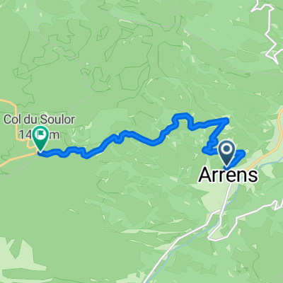
COL DU SOULOR / ARRENS MARSOUS
Cycling route in Argelès-Gazost, Languedoc-Roussillon-Midi-Pyrénées, France
- 7.1 km
- Distance
- 637 m
- Ascent
- 70 m
- Descent

tourdefr
Cycling route in Argelès-Gazost, Languedoc-Roussillon-Midi-Pyrénées, France
- 9.8 km
- Distance
- 639 m
- Ascent
- 209 m
- Descent
Discover more routes
 Argeles-Gazost Soulour
- Distance
- 19.8 km
- Ascent
- 1,017 m
- Descent
- 29 m
- Location
- Argelès-Gazost, Languedoc-Roussillon-Midi-Pyrénées, France
 SOULOR, por Argelès-Gazost
- Distance
- 20.1 km
- Ascent
- 1,084 m
- Descent
- 57 m
- Location
- Argelès-Gazost, Languedoc-Roussillon-Midi-Pyrénées, France
 Argeles Gazost-Col du Soulour-Col d'Aubisque-Gourette
- Distance
- 34.2 km
- Ascent
- 1,419 m
- Descent
- 512 m
- Location
- Argelès-Gazost, Languedoc-Roussillon-Midi-Pyrénées, France
 Ascension a Aubisque
- Distance
- 30.5 km
- Ascent
- 1,395 m
- Descent
- 120 m
- Location
- Argelès-Gazost, Languedoc-Roussillon-Midi-Pyrénées, France
 Argeles-abisque
- Distance
- 29.7 km
- Ascent
- 1,572 m
- Descent
- 318 m
- Location
- Argelès-Gazost, Languedoc-Roussillon-Midi-Pyrénées, France
 A13 ArgelesGazost Aubisque
- Distance
- 31.5 km
- Ascent
- 1,482 m
- Descent
- 240 m
- Location
- Argelès-Gazost, Languedoc-Roussillon-Midi-Pyrénées, France
 COL DU SOULOR / ARRENS MARSOUS
- Distance
- 7.1 km
- Ascent
- 637 m
- Descent
- 70 m
- Location
- Argelès-Gazost, Languedoc-Roussillon-Midi-Pyrénées, France
 tourdefr
- Distance
- 9.8 km
- Ascent
- 639 m
- Descent
- 209 m
- Location
- Argelès-Gazost, Languedoc-Roussillon-Midi-Pyrénées, France
Routes from Argelès-Gazost
Cycling day trip from
Argelès-Gazost to Campan
Cycling day trip from
Argelès-Gazost to Arette
Quick ride by bicycle from
Argelès-Gazost to Pierrefitte-Nestalas
Routes to Laruns
Cycling day trip from
Saint-Jean-Pied-de-Port to Laruns
Cycling day trip from
Luz-Saint-Sauveur to Laruns