
Cycling in San Antonio
Discover a map of 588 cycling routes and bike trails near San Antonio, created by our community.
Region portrait
Get to know San Antonio
Find the right bike route for you through San Antonio, where we've got 588 cycle routes to explore. Most people get on their bikes to ride here in the months of April and May.
13,982 km
Tracked distance
588
Cycle routes
1.3 million
Population
Community
Most active users in San Antonio


From our community
The best bike routes in and around San Antonio


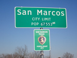

San Antonio to San Marcos
Cycling route in San Antonio, Texas, United States of America
Getting out of downtown and through the first few miles wasn't a problem. However, getting onto Lookout Road and then onto the service road for I-35 was less than great riding. The initial part of Lookout Road was in terrible condition. And when the road improved, the traffic got heavy.
The service
- 89.1 km
- Distance
- 428 m
- Ascent
- 460 m
- Descent

Pearl to mission tentative 5-16-19
Cycling route in San Antonio, Texas, United States of America
- 45 km
- Distance
- 80 m
- Ascent
- 77 m
- Descent


East Travis Street 130, San Antonio nach Hiler Road 106, San Antonio
Cycling route in San Antonio, Texas, United States of America
- 12.2 km
- Distance
- 96 m
- Ascent
- 47 m
- Descent

bike tour through San Antonio
Cycling route in San Antonio, Texas, United States of America
- 22.7 km
- Distance
- 97 m
- Ascent
- 97 m
- Descent
Discover more routes
 River Walk, San Antonio to 1012–1024 Piedmont Ave, San Antonio
- Distance
- 4.7 km
- Ascent
- 44 m
- Descent
- 16 m
- Location
- San Antonio, Texas, United States of America
 116 Blue Star, San Antonio to 116 Blue Star, San Antonio
- Distance
- 31.3 km
- Ascent
- 638 m
- Descent
- 637 m
- Location
- San Antonio, Texas, United States of America
 2420 S Flores St, San Antonio to 120 Blue Star, San Antonio
- Distance
- 67.9 km
- Ascent
- 391 m
- Descent
- 381 m
- Location
- San Antonio, Texas, United States of America
 Easy Ride through mostly neighborhoods
- Distance
- 8.6 km
- Ascent
- 37 m
- Descent
- 39 m
- Location
- San Antonio, Texas, United States of America
 1215 S Alamo St, San Antonio to 116 Blue Star, San Antonio
- Distance
- 24.4 km
- Ascent
- 195 m
- Descent
- 196 m
- Location
- San Antonio, Texas, United States of America
 Route De Meli
- Distance
- 4.4 km
- Ascent
- 12 m
- Descent
- 13 m
- Location
- San Antonio, Texas, United States of America
 Woodlawn Elmendorph Lake Tour
- Distance
- 48.2 km
- Ascent
- 197 m
- Descent
- 197 m
- Location
- San Antonio, Texas, United States of America
 Woodlawn to Espada Tour
- Distance
- 46.5 km
- Ascent
- 185 m
- Descent
- 187 m
- Location
- San Antonio, Texas, United States of America