
Cycling in Colmar
Discover a map of 1,089 cycling routes and bike trails near Colmar, created by our community.
Region portrait
Get to know Colmar
Find the right bike route for you through Colmar, where we've got 1,089 cycle routes to explore. Most people get on their bikes to ride here in the months of July and August.
83,682 km
Tracked distance
1,089
Cycle routes
65,405
Population
Community
Most active users in Colmar


From our community
The best bike routes in and around Colmar

TdF Freitag
Cycling route in Colmar, Alsace-Champagne-Ardenne-Lorraine, France
- 111.5 km
- Distance
- 1,950 m
- Ascent
- 1,759 m
- Descent
Tour de France 2009, Etappe 14 - 199,0 km
Cycling route in Colmar, Alsace-Champagne-Ardenne-Lorraine, France
Cloned from:
<span style="color: #000000; font-family: Helvetica; font-size: 12px;">http://www.bikemap.net/route/102382</span>
- 198.3 km
- Distance
- 519 m
- Ascent
- 466 m
- Descent

Von Colmar nach Châtenois
Cycling route in Colmar, Alsace-Champagne-Ardenne-Lorraine, France
- 51.6 km
- Distance
- 345 m
- Ascent
- 354 m
- Descent

Alsace Jour 2
Cycling route in Colmar, Alsace-Champagne-Ardenne-Lorraine, France
Alsace Jour 2
(cloned from route 2622713)
- 88.4 km
- Distance
- 1,325 m
- Ascent
- 1,325 m
- Descent
Discover more routes
 Colmar_Horbourg_Wihr_Auberge_Neuland
- Distance
- 10.5 km
- Ascent
- 16 m
- Descent
- 17 m
- Location
- Colmar, Alsace-Champagne-Ardenne-Lorraine, France
 COLMAR-COLMAR via KB/trois epis 50KMS
- Distance
- 48.2 km
- Ascent
- 609 m
- Descent
- 605 m
- Location
- Colmar, Alsace-Champagne-Ardenne-Lorraine, France
 TdF 09 Colmar-Colmar
- Distance
- 155.8 km
- Ascent
- 3,542 m
- Descent
- 3,333 m
- Location
- Colmar, Alsace-Champagne-Ardenne-Lorraine, France
 Golmar
- Distance
- 48.2 km
- Ascent
- 684 m
- Descent
- 685 m
- Location
- Colmar, Alsace-Champagne-Ardenne-Lorraine, France
 Deutschland - Portugal (Berlin - Faro) FR 06 Colmar - Mulhouse
- Distance
- 49.4 km
- Ascent
- 71 m
- Descent
- 13 m
- Location
- Colmar, Alsace-Champagne-Ardenne-Lorraine, France
 CYCLING THE RHINE: Route R02A
- Distance
- 87.2 km
- Ascent
- 47 m
- Descent
- 105 m
- Location
- Colmar, Alsace-Champagne-Ardenne-Lorraine, France
 Colmar-trois epis-c.d.Linge-c.d.Wettsein-L.Noir-L.Blanc-c.d.Calvaire-C.d.l.Schlucht-Hoheneck-Metzeral-Colmar
- Distance
- 88.2 km
- Ascent
- 1,329 m
- Descent
- 1,333 m
- Location
- Colmar, Alsace-Champagne-Ardenne-Lorraine, France
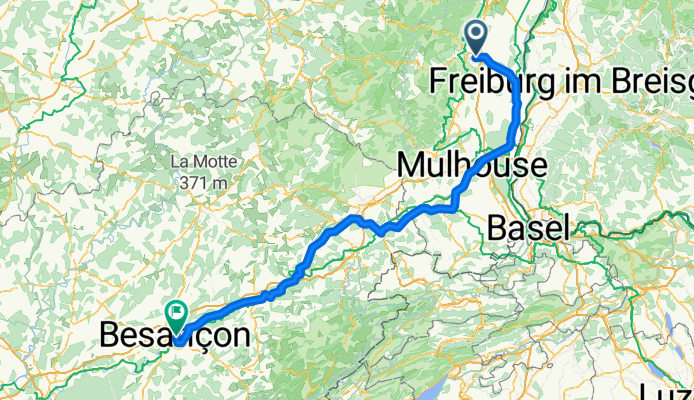
 Etappe 14 Tour de France 2009 von Colmar nach Besançon
- Distance
- 202.5 km
- Ascent
- 1,131 m
- Descent
- 1,003 m
- Location
- Colmar, Alsace-Champagne-Ardenne-Lorraine, France
Routes from Colmar
Cycling day trip from
Colmar to Freiburg
Cycling day trip from
Colmar to Mulhouse
Routes to Colmar
Cycling day trip from
Basel to Colmar
Cycling day trip from
Strasbourg to Colmar