
Cycling in Dieulefit
Discover a map of 262 cycling routes and bike trails near Dieulefit, created by our community.
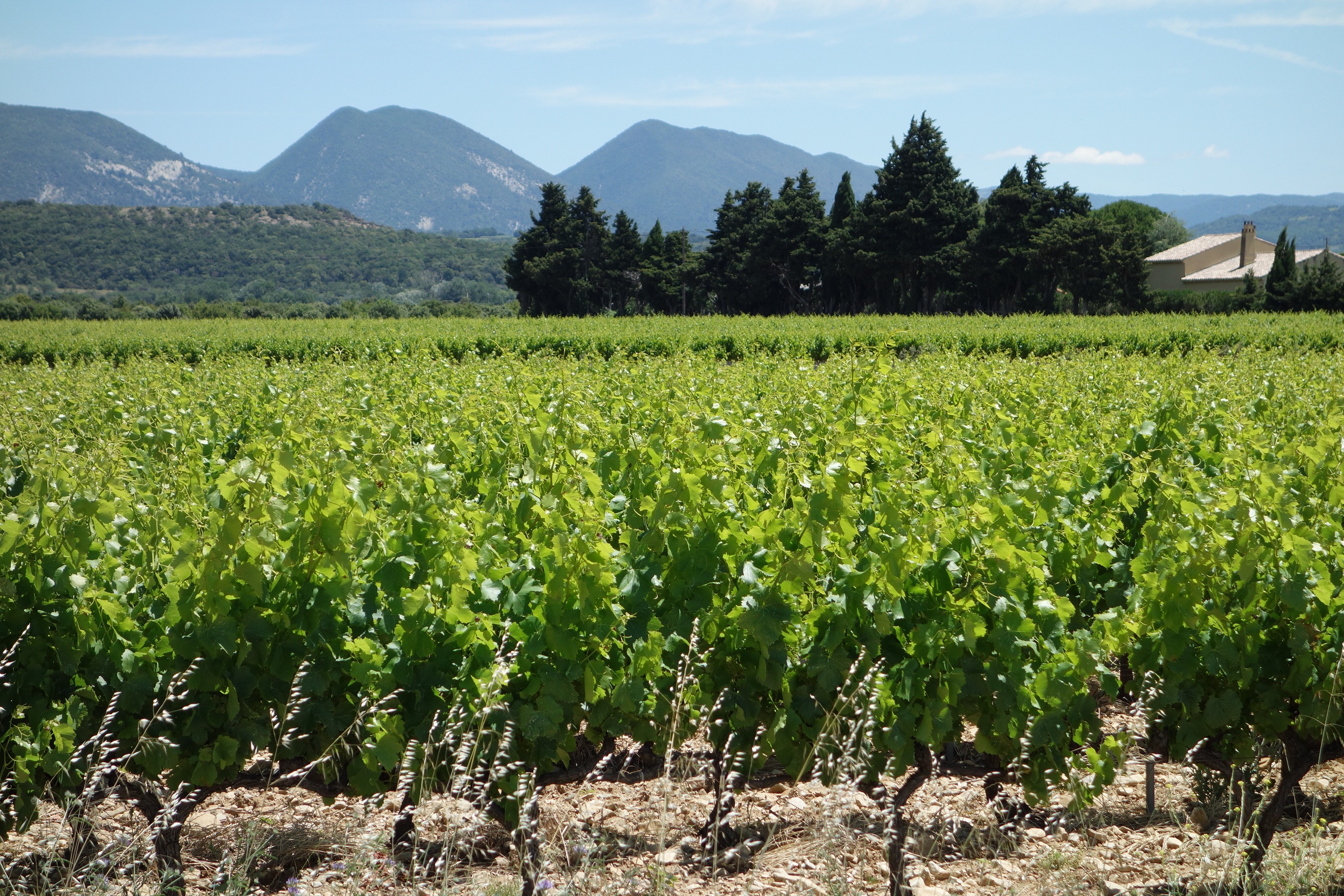
Region portrait
Get to know Dieulefit
Find the right bike route for you through Dieulefit, where we've got 262 cycle routes to explore. Most people get on their bikes to ride here in the months of July and August.
17,243 km
Tracked distance
262
Cycle routes
3,214
Population
Community
Most active users in Dieulefit


From our community
The best bike routes in and around Dieulefit


2016 Ride Day 101 - Vesc Circle to Col de la Chaudière
Cycling route in Dieulefit, Auvergne-Rhône-Alpes, France
Fantastic ride on zero and low-traffic roads, with the exception of the portion along the Drôme River where there was excellent road shoulder.
Super climbing and descending. We highly recommend this route.
- 76.9 km
- Distance
- 1,318 m
- Ascent
- 1,319 m
- Descent


2016 Ride Day 99 - Vesc Circle
Cycling route in Dieulefit, Auvergne-Rhône-Alpes, France
Nice ride on all low and zero traffic roads. Highly recommend.
- 40.1 km
- Distance
- 782 m
- Ascent
- 781 m
- Descent


2016 Ride Day 100 - Vesc Circle to Valréas
Cycling route in Dieulefit, Auvergne-Rhône-Alpes, France
Good ride, though not great. Mostly good roads with little traffic. D540 has good shoulders so traffic on it not a problem.
- 75.5 km
- Distance
- 713 m
- Ascent
- 713 m
- Descent


2016 Ride Day 102 - Vesc Circle to St-Nazaire-le-Désert
Cycling route in Dieulefit, Auvergne-Rhône-Alpes, France
This was a relatively short ride on solely low and zero-traffic roads. For the full time on D202, we saw zero cars. Great countryside and excellent roads.
Rode through Col de l'Homme (616M), Col de Lescou (819M), and Col de Muse (932M).
We highly recommend.
- 52.5 km
- Distance
- 1,048 m
- Ascent
- 1,048 m
- Descent
Discover more routes
 2016 Ride Day 103 - Vesc Circle to Valence
- Distance
- 70.2 km
- Ascent
- 243 m
- Descent
- 670 m
- Location
- Dieulefit, Auvergne-Rhône-Alpes, France
 53k Dieulefit
- Distance
- 52.3 km
- Ascent
- 821 m
- Descent
- 815 m
- Location
- Dieulefit, Auvergne-Rhône-Alpes, France
 Col de la Chaudière
- Distance
- 91.8 km
- Ascent
- 1,616 m
- Descent
- 1,620 m
- Location
- Dieulefit, Auvergne-Rhône-Alpes, France
 2014 sainte jalle nord 109 km
- Distance
- 108.7 km
- Ascent
- 1,782 m
- Descent
- 1,803 m
- Location
- Dieulefit, Auvergne-Rhône-Alpes, France
 Gorges de 30 pas
- Distance
- 54.1 km
- Ascent
- 1,051 m
- Descent
- 960 m
- Location
- Dieulefit, Auvergne-Rhône-Alpes, France
 Etape 4 Eté 2022
- Distance
- 48.8 km
- Ascent
- 743 m
- Descent
- 840 m
- Location
- Dieulefit, Auvergne-Rhône-Alpes, France
 Bourdeaux 1
- Distance
- 62.6 km
- Ascent
- 1,014 m
- Descent
- 1,014 m
- Location
- Dieulefit, Auvergne-Rhône-Alpes, France
 tour autour st nazaire
- Distance
- 113.6 km
- Ascent
- 2,256 m
- Descent
- 2,256 m
- Location
- Dieulefit, Auvergne-Rhône-Alpes, France