
Cycling in Wartenberg
Discover a map of 174 cycling routes and bike trails near Wartenberg, created by our community.
Region portrait
Get to know Wartenberg
Find the right bike route for you through Wartenberg, where we've got 174 cycle routes to explore. Most people get on their bikes to ride here in the months of June and July.
4,308 km
Tracked distance
174
Cycle routes
2,336
Population
Community
Most active users in Wartenberg


From our community
The best bike routes in and around Wartenberg

GPS Mügelseerunde
Cycling route in Wartenberg, Land Berlin, Germany
- 71.7 km
- Distance
- 78 m
- Ascent
- 81 m
- Descent

Kusunoki´s Berlin-Erkner-Altlandsbergtour 80 Km
Cycling route in Wartenberg, Land Berlin, Germany
Hinter Grünheide unbedingt Fahrradweg im Wald meiden, holprig und glatt aufgrund Feuchtigkeit und Blätter, enge Kurven, Sturzgefahr
- 80.8 km
- Distance
- 104 m
- Ascent
- 106 m
- Descent

Bln HsH - Potsdam - Brandenburg a.d.H. 86,7 Km
Cycling route in Wartenberg, Land Berlin, Germany
Ab Großglienicke bis Brandenburg ein super Fahrradweg vorhanden, teilweise nur auf einer Straßenseite, aber Topzustand.
- 86.8 km
- Distance
- 137 m
- Ascent
- 164 m
- Descent

Gerade Fahrt in Bernau bei Berlin
Cycling route in Wartenberg, Land Berlin, Germany
- 57.7 km
- Distance
- 395 m
- Ascent
- 375 m
- Descent
Discover more routes
 Schweriner Ring 38, Berlin nach Schweriner Ring 38, Berlin
- Distance
- 37 km
- Ascent
- 129 m
- Descent
- 126 m
- Location
- Wartenberg, Land Berlin, Germany
 Ückeritzer Ring 31a, Berlin nach Ückeritzer Ring 31a, Berlin
- Distance
- 27.1 km
- Ascent
- 84 m
- Descent
- 87 m
- Location
- Wartenberg, Land Berlin, Germany
 Zu Kühne
- Distance
- 11.1 km
- Ascent
- 85 m
- Descent
- 98 m
- Location
- Wartenberg, Land Berlin, Germany
 Hagenower Ring 32, Berlin nach Hagenower Ring 34, Berlin
- Distance
- 34 km
- Ascent
- 139 m
- Descent
- 139 m
- Location
- Wartenberg, Land Berlin, Germany
 Berlin HSH - Bernau - Eberswalde - Bad Freienwalde - Wriezen - Strausberg - Alt Landsberg - Bln HSH 135 Km
- Distance
- 134.6 km
- Ascent
- 303 m
- Descent
- 303 m
- Location
- Wartenberg, Land Berlin, Germany
 Exploring Malchower See
- Distance
- 8.4 km
- Ascent
- 20 m
- Descent
- 24 m
- Location
- Wartenberg, Land Berlin, Germany
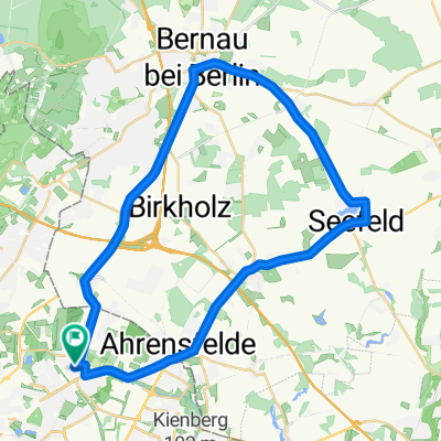 Hohenschönhausen - Bernau - Seefeld - Hohenschönhausen
- Distance
- 37.8 km
- Ascent
- 69 m
- Descent
- 66 m
- Location
- Wartenberg, Land Berlin, Germany
 Schweriner Ring 65, Berlin nach Schweriner Ring 79, Berlin
- Distance
- 23.6 km
- Ascent
- 60 m
- Descent
- 60 m
- Location
- Wartenberg, Land Berlin, Germany