
Cycling in Gallizien
Discover a map of 115 cycling routes and bike trails near Gallizien, created by our community.
Region portrait
Get to know Gallizien
Find the right bike route for you through Gallizien, where we've got 115 cycle routes to explore. Most people get on their bikes to ride here in the months of May and June.
5,439 km
Tracked distance
115
Cycle routes
Community
Most active users in Gallizien


From our community
The best bike routes in and around Gallizien

KäS5: Grafenstein-Velden; 75,2km 360hm
Cycling route in Gallizien, Carinthia, Austria
Saager - (R1) - Stein - Littermoos - (3 Seen) - (R1H) Peratschitzen - Bei der Drau - (R1) - Wölfnitz - (Graf) - Ebenthal - (R6) - Klagenfurt - (R4) - Krumpendorf - Pörtschach - Töschling - Saag - Velden
Bacherlwirt Hotel&Restaurant, Rosentaler Str. 22, 9220 Velden
- 75.2 km
- Distance
- 559 m
- Ascent
- 508 m
- Descent

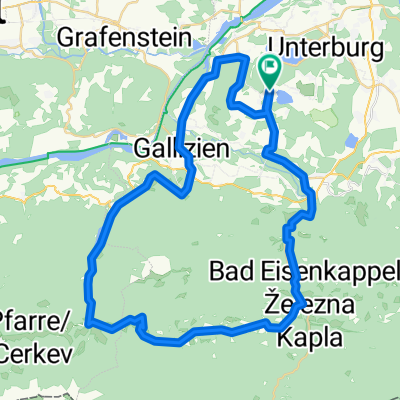
Podhorská etapa Jaunstein k lanovce Unterort.
Cycling route in Gallizien, Carinthia, Austria
Kopcovitější v podhůří, lze i lanovkou do 1700 m, nebo v Jaunsteinu zkrátit asi na 35 a opět se vykoupat v Turnersee.
- 51 km
- Distance
- 294 m
- Ascent
- 308 m
- Descent

Kolem Volkermarkterské přehrady .
Cycling route in Gallizien, Carinthia, Austria
Kolem přehrady na Drávě, prohlídka Voelkermarkt a zpět k Turnersee s koupáním.
- 33.9 km
- Distance
- 315 m
- Ascent
- 334 m
- Descent

Hochobir-Strecke
Cycling route in Gallizien, Carinthia, Austria
Diese Urlaubsstrecke geht von unserem Hotel zur Eisenkappeler-Hütte, von wo aus man dann nur noch zu Fuß bis zur Bergspitze kommt.
- 30.6 km
- Distance
- 1,535 m
- Ascent
- 871 m
- Descent
Discover more routes
 Klopeinské jezero - Klagenfurt a z5
- Distance
- 70.3 km
- Ascent
- 897 m
- Descent
- 897 m
- Location
- Gallizien, Carinthia, Austria
 Annabrücke Eberndorf Klopeinersee
- Distance
- 36.3 km
- Ascent
- 288 m
- Descent
- 289 m
- Location
- Gallizien, Carinthia, Austria
 Unternarrach 50 naar Turnersee Campingplatz
- Distance
- 56.9 km
- Ascent
- 1,179 m
- Descent
- 1,197 m
- Location
- Gallizien, Carinthia, Austria
 Donnerstag 08.07 29KM 160Hm Annabrücke
- Distance
- 28.7 km
- Ascent
- 128 m
- Descent
- 141 m
- Location
- Gallizien, Carinthia, Austria
 Seidendorf - Wörthersee - Drauweg - Seidendorf - Seidendorf - Wörthersee - Drauweg - Seidendorf
- Distance
- 75.7 km
- Ascent
- 606 m
- Descent
- 606 m
- Location
- Gallizien, Carinthia, Austria
 Turnersee Campingplatz naar Vesielacher Straße 12
- Distance
- 62.8 km
- Ascent
- 1,577 m
- Descent
- 1,572 m
- Location
- Gallizien, Carinthia, Austria
 Po řece Velach
- Distance
- 33.3 km
- Ascent
- 642 m
- Descent
- 627 m
- Location
- Gallizien, Carinthia, Austria
 Koschutarunde
- Distance
- 49.3 km
- Ascent
- 640 m
- Descent
- 640 m
- Location
- Gallizien, Carinthia, Austria