
Cycling in Warwick
Discover a map of 169 cycling routes and bike trails near Warwick, created by our community.
Region portrait
Get to know Warwick
Find the right bike route for you through Warwick, where we've got 169 cycle routes to explore. Most people get on their bikes to ride here in the months of April and May.
5,065 km
Tracked distance
169
Cycle routes
24,040
Population
Community
Most active users in Warwick


From our community
The best bike routes in and around Warwick

Route 18 (Stratford-upon-Avon)
Cycling route in Warwick, England, United Kingdom
Start: Chase Meadow Estate, Warwick
Finish: Bridge Town/The Tramway, Stratford upon Avon
Route: Stratford Road, Longbridge M40 cycle path, Sherbourne, Hampton Lucy, Charlecote, Wellesbourne Airfield, NCN Route 41, Loxley, Loxley Road, Dale Avenue, Rushbrook Road, Kipling Road cycl
- 19 km
- Distance
- 104 m
- Ascent
- 114 m
- Descent

Route 12 (Norton Lindsey)
Cycling route in Warwick, England, United Kingdom
Start: Barcheston Drive, Hatton Park
Finish: Quinton Close, Hatton Park
Route: Charingworth Drive, Ugly Bridge Road cycle path, (A4177 crossing), Ugly Bridge Road, Woodway, Hampton on the Hill, Old School Lane, Henley Road, Warwick Road, Littleworth, Norton Lindsey, Brittons Lane,
- 15.8 km
- Distance
- 132 m
- Ascent
- 134 m
- Descent

Route 15 (Lowsonford)
Cycling route in Warwick, England, United Kingdom
Start: Church Lane, Hampton Magna
Finish: Preston Bagot
Route: Old Budbrooke Road, Hampton on the Hill, Old School Lane, Henley Road, Warwick Road, Littleworth, Norton Lindsey, Brittons Lane, Norton Curlieu, Dark Lane, Nunhold Grange, Pinley Green, High Cross Lane, Narrow Lane, Lo
- 15.6 km
- Distance
- 144 m
- Ascent
- 136 m
- Descent

Warwick to Kenilworth
Cycling route in Warwick, England, United Kingdom
Warwick to Kenilworth most direct route
- 7.4 km
- Distance
- 56 m
- Ascent
- 32 m
- Descent
Discover more routes
 Day 2 - Warwick to Cirencester
- Distance
- 93 km
- Ascent
- 826 m
- Descent
- 762 m
- Location
- Warwick, England, United Kingdom
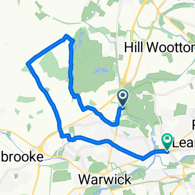 Route to 133 Warwick New Road, Royal Leamington Spa
- Distance
- 11.9 km
- Ascent
- 104 m
- Descent
- 95 m
- Location
- Warwick, England, United Kingdom
 Route 14 (Aston Cantlow)
- Distance
- 15.8 km
- Ascent
- 110 m
- Descent
- 119 m
- Location
- Warwick, England, United Kingdom
 Route 16 (Wilmcote)
- Distance
- 16.5 km
- Ascent
- 138 m
- Descent
- 154 m
- Location
- Warwick, England, United Kingdom
 Route 11 (Rouncil Lane)
- Distance
- 16.5 km
- Ascent
- 115 m
- Descent
- 121 m
- Location
- Warwick, England, United Kingdom
 Route 10 (Shrewley)
- Distance
- 14.1 km
- Ascent
- 97 m
- Descent
- 110 m
- Location
- Warwick, England, United Kingdom
 Route 9 (Hampton Lucy)
- Distance
- 14.1 km
- Ascent
- 103 m
- Descent
- 82 m
- Location
- Warwick, England, United Kingdom
 Roads to Cath and Steve
- Distance
- 18.8 km
- Ascent
- 46 m
- Descent
- 79 m
- Location
- Warwick, England, United Kingdom