
Cycling in Leeston
Discover a map of 10 cycling routes and bike trails near Leeston, created by our community.
Be a pioneer
Inspire fellow cyclists with your route in Leeston
Bikemap is a global cycling community with millions of routes created by cyclists like you. There are only a few routes so far in Leeston, so plot your favourite rides on the map now to help others find the best ways to ride.
From our community
The best bike routes in and around Leeston

Leeston to Christchurch
Cycling route in Leeston, Canterbury, New Zealand
- 44.4 km
- Distance
- 68 m
- Ascent
- 77 m
- Descent

Southbridge/Leeston/Feredays Rd
Cycling route in Leeston, Canterbury, New Zealand
- 16.2 km
- Distance
- 30 m
- Ascent
- 27 m
- Descent

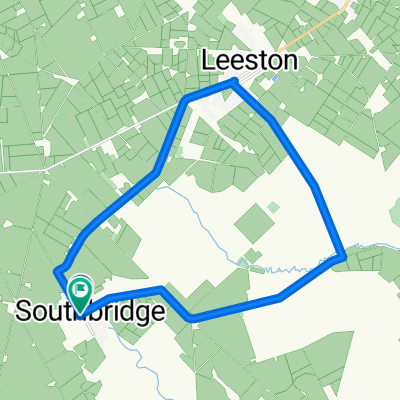
Southbridge/Leeston/Duns Rd
Cycling route in Leeston, Canterbury, New Zealand
- 32.2 km
- Distance
- 46 m
- Ascent
- 46 m
- Descent

Discover more routes
 Southbridge/Cryers Rd
- Distance
- 16.1 km
- Ascent
- 13 m
- Descent
- 11 m
- Location
- Leeston, Canterbury, New Zealand
 807–887 The Lake Road, Leeston to 22 Mountain View Place, Leeston
- Distance
- 20.1 km
- Ascent
- 52 m
- Descent
- 35 m
- Location
- Leeston, Canterbury, New Zealand
 Southbridge/Doyleston/Leeston/Duns Rd
- Distance
- 27.8 km
- Ascent
- 25 m
- Descent
- 24 m
- Location
- Leeston, Canterbury, New Zealand
 Southbridge/Lake Rd Sth
- Distance
- 32.7 km
- Ascent
- 39 m
- Descent
- 40 m
- Location
- Leeston, Canterbury, New Zealand
 Southbridge/Lakeside
- Distance
- 19.3 km
- Ascent
- 29 m
- Descent
- 29 m
- Location
- Leeston, Canterbury, New Zealand
 Southbridge/Leeston/Dunsandel Rd via Kings
- Distance
- 22.3 km
- Ascent
- 35 m
- Descent
- 32 m
- Location
- Leeston, Canterbury, New Zealand