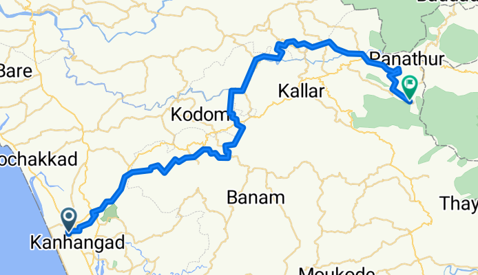
Cycling in Kanhangad
Discover a map of 12 cycling routes and bike trails near Kanhangad, created by our community.
Region portrait
Get to know Kanhangad
Find the right bike route for you through Kanhangad, where we've got 12 cycle routes to explore.
1,450 km
Tracked distance
12
Cycle routes
68,450
Population
Community
Most active users in Kanhangad
From our community
The best bike routes in and around Kanhangad
Route to Ranipuram
Cycling route in Kanhangad, Kerala, India
- 58.6 km
- Distance
- 2,397 m
- Ascent
- 1,719 m
- Descent
Pullur - Pannikkunnu Road to Kanhangad - Rajapuram - Malom Road
Cycling route in Kanhangad, Kerala, India
- 40.3 km
- Distance
- 758 m
- Ascent
- 339 m
- Descent
845G+JPM, Kasaragod to 74MW+HHC, Kakkat
Cycling route in Kanhangad, Kerala, India
- 5.4 km
- Distance
- 63 m
- Ascent
- 42 m
- Descent
Discover more routes
 Route from South School Road, Kanhangad
- Distance
- 27.8 km
- Ascent
- 189 m
- Descent
- 186 m
- Location
- Kanhangad, Kerala, India
 nileshwaram route
- Distance
- 13.2 km
- Ascent
- 33 m
- Descent
- 33 m
- Location
- Kanhangad, Kerala, India
 cuk to goa
- Distance
- 501 km
- Ascent
- 2,854 m
- Descent
- 2,838 m
- Location
- Kanhangad, Kerala, India
 kanganhad trip
- Distance
- 18.2 km
- Ascent
- 124 m
- Descent
- 122 m
- Location
- Kanhangad, Kerala, India
 Kalluravi Road, Kanhangad to Departure Road, Mattannur
- Distance
- 86.4 km
- Ascent
- 577 m
- Descent
- 505 m
- Location
- Kanhangad, Kerala, India
 Kalluravi Road, Kanhangad to PVS Road, Mangaluru
- Distance
- 75.4 km
- Ascent
- 553 m
- Descent
- 531 m
- Location
- Kanhangad, Kerala, India
 All kerala ride
- Distance
- 514.2 km
- Ascent
- 1,294 m
- Descent
- 1,306 m
- Location
- Kanhangad, Kerala, India
 Kalluravi Road, Kanhangad to Bank Road, Kasaragod
- Distance
- 28.7 km
- Ascent
- 218 m
- Descent
- 205 m
- Location
- Kanhangad, Kerala, India


