
Aug/Sep 2020+2021 local rides
A collection of 12 cycling routes, created by puddock.
- 12
- Routes
- -:--
- Duration
- 798.3 km
- Distance
- ---
- Avg. speed
- 5,906 m
- Ascent
- 5,910 m
- Descent
About this collection
A menu of local routes to pick from
Created by


Route 1 Adlington to Wildboarclough loop. 26 miles, hilly
Cycling route in Adlington, England, United Kingdom
- 41.9 km
- Distance
- 639 m
- Ascent
- 639 m
- Descent

Route 2 Parsley Hay circular via Monsal Trail and High Peak Trail
Cycling route in Bakewell, England, United Kingdom
- 63.6 km
- Distance
- 607 m
- Ascent
- 608 m
- Descent

Route 3 Parsley Hay to Ashbourne, return via Hulme End
Cycling route in Bakewell, England, United Kingdom
- 58.1 km
- Distance
- 653 m
- Ascent
- 655 m
- Descent
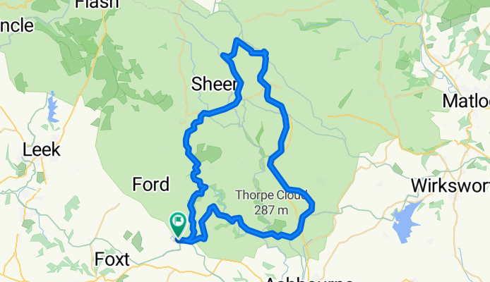
Route 4 Waterhouses circuit to Manifold and Tissington Trails
Cycling route in Mayfield, England, United Kingdom
- 54.8 km
- Distance
- 497 m
- Ascent
- 503 m
- Descent

Route 5 Davenham and south to Wrenbury
Cycling route in Northwich, England, United Kingdom
- 74.8 km
- Distance
- 209 m
- Ascent
- 207 m
- Descent

Route 6 Dodleston - Llangollen circular
Cycling route in Rossett, Wales, United Kingdom
- 73.4 km
- Distance
- 554 m
- Ascent
- 554 m
- Descent

Route 7 Delamere Forest to N Wales circuit
Cycling route in Oakmere, England, United Kingdom
- 88.8 km
- Distance
- 467 m
- Ascent
- 466 m
- Descent

Route 8 Middlewich circuit to Ellesmere and Wem
Cycling route in Middlewich, England, United Kingdom
- 121.2 km
- Distance
- 284 m
- Ascent
- 284 m
- Descent

Route 10 Carsington Water circular
Cycling route in Ashbourne, England, United Kingdom
- 43.6 km
- Distance
- 513 m
- Ascent
- 514 m
- Descent

Route 11 Adlington to Buxton and Wildboarclough
Cycling route in Adlington, England, United Kingdom
- 57 km
- Distance
- 1,027 m
- Ascent
- 1,027 m
- Descent


Aughton - Southport circular 40 miles
Cycling route in Maghull, England, United Kingdom
- 63.9 km
- Distance
- 160 m
- Ascent
- 160 m
- Descent

Flint - Prestatyn circular
Cycling route in Flint, Wales, United Kingdom
- 57 km
- Distance
- 296 m
- Ascent
- 293 m
- Descent
All routes on the map
You can open and navigate all the routes in the Bikemap app for iOS and Android or continue on web to see all details and routes on the map.